AllWays Traveller Features
A Different Way To Everest

I found out recently that the classic route isn't the only way to reach Everest Base Camp in Nepal. I've just been the hard way!
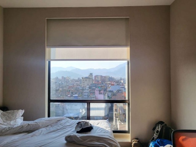
When I took the picture above... I was the other end of a long flight, too far away to go home. I was sharing this room with a stranger who became a good friend. Anticipating a trek which I hoped would become an adventure and that I would be up to the challenge of completing it. It did and I was.

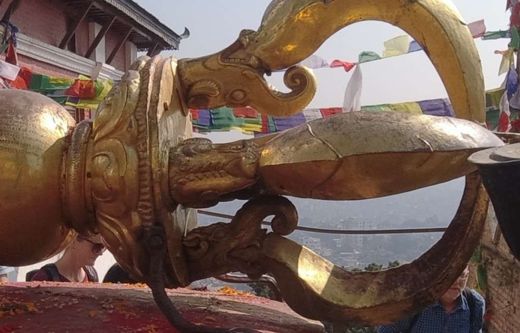
Kathmandu, reputed to be one of the oldest cities in the world is the start and end point of any trek to Everest. The ancient city sprawls over the floor of the Kathmandu Valley with a population of close to a million people. It is littered with shopping malls and ancient Buddhist Temples. An offshoot of the Ganges River, sacred in the Hindu faith, passes through the city and bodies are cremated on its banks.
The Varja (Pictured above, right) symbolises peace, wisdom and light. Prayer flags coloured to represent the five pure lights; space, air, water, fire and earth, flutter in the wind sending mantras to heaven.

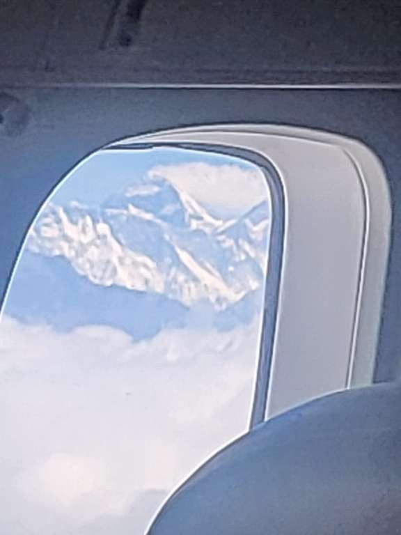
Soon, I was aboard a small turbo prop plane heading to the most dangerous airport in the world. We'd be landing in a place called Lukla. On a ledge on a cliff halfway up a mountain.
(Above, right) Not the best shot but what a subject. The summit of Everest through the window of the plane on the short flight to Lukla.
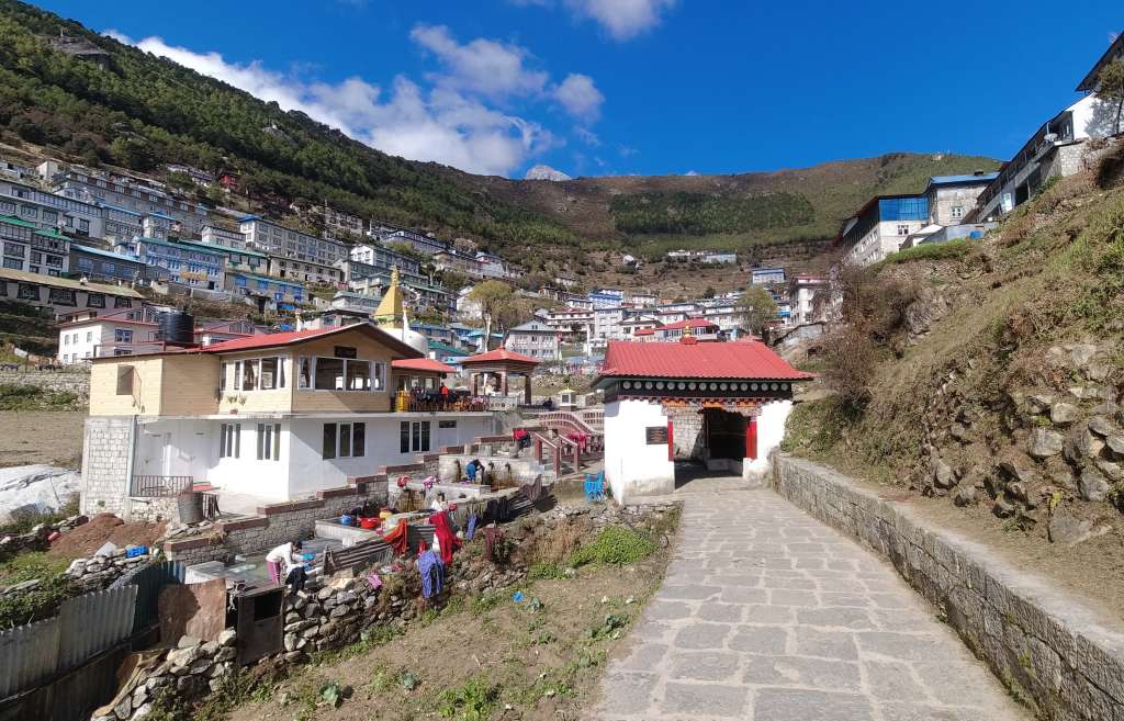
Nam-che-baz-zar wooo-oo-oo-oo! (Those who've heard me sing it will know.)
Namche Bazaar sits high in the mountains at an altitude of around 3,440m (11,286ft). It's one of the main Sherpa Settlements in the area and has lots of shopping and several bars.

Dead centre of this picture is the highest point on earth. The summit of Everest standing at 8,850m (29,032ft) above mean sea level. The cloud sweeping over her indicates the jet stream with winds of up to 140mph.
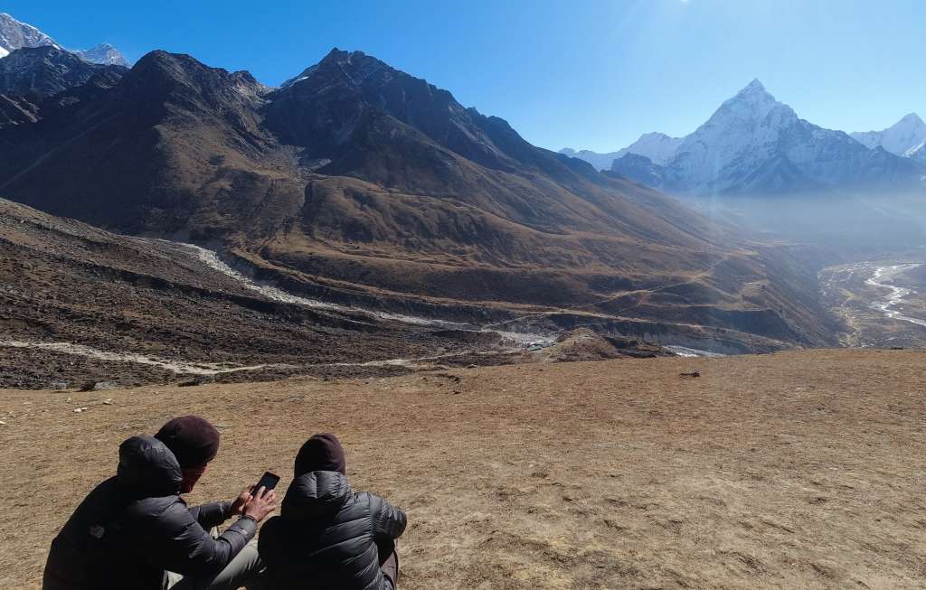
This is the incredible panorama before us as we acclimatise in the hills above Namche Bazaar. Looking right from Everest we see the summit of Lhotse also in the jet stream. Further right and closest to us is the summit of Ama Dablam.
We're standing at a mere 3,900m (12,987ft) above mean sea level. By climbing to this height and then descending to Namche Bazaar at 3,440m (11,286ft) for the night we are helping our bodies adjust to the ever-thinning air.
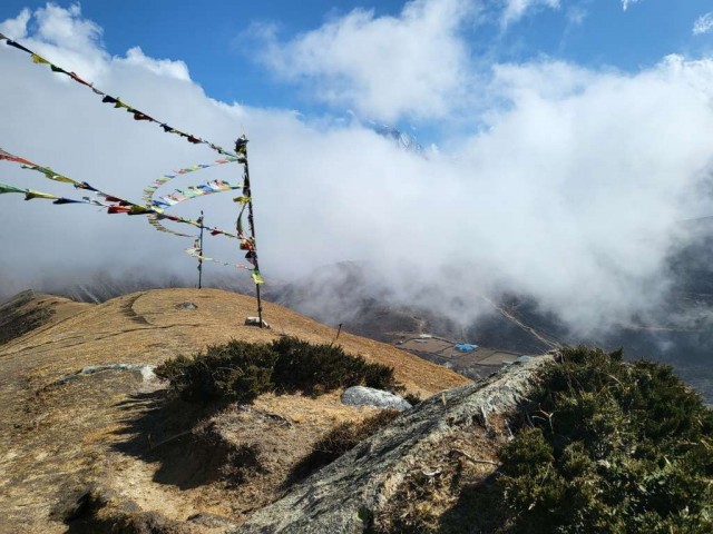
The best way to spend a 'rest day' is to climb above the place you are staying and acclimatize. Doing just that, I look down among the Prayer Flags and the clouds to the settlement of Machermo where we are staying high in the Gokyo Valley.
On reflection, this was my most confident part of the trek. I was out on my own climbing slowly and mind wandering. It was one of those times when I just knew I could take whatever this trek could throw at me.
As afternoon mist rolls over the mountains like a huge tsunami, I send the tune of a hymn whistling into the silence. "For you are always close to me. Following all my ways. May I be always close to you. Following all your ways Lord." If the next valley, beyond life, is as beautiful as the one before me now, then I know all will be well.
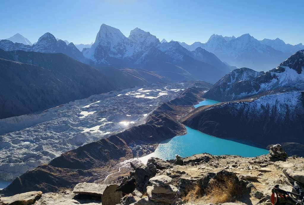
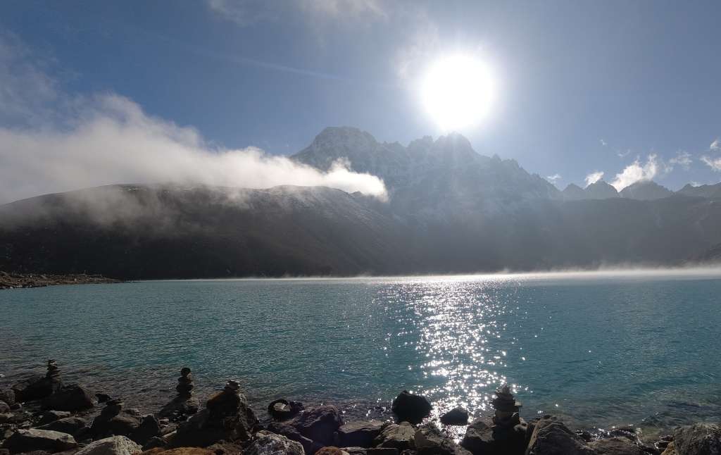
Looking down from the summit of Gokyo Ri. 5,357m (17,575ft) The village of Gokyo looks tiny before the valley's third and largest lake. Behind it, the chaotic mess of the Ngozumpa Glacier rolls down the valley.
At once I am exhausted, ill, elated, and apprehensive. The climb was steep, dark, and freezing. My water supply froze. I'm really feeling the altitude. After a sip of water, I started uncontrollably hyper ventilating and nearly passed out twice on the way up. My head is pounding and my eyes bulge in time with my racing pulse.
This valley emerging from the darkness into the sunrise was one of the most incredible things I've ever seen. For all that ails me still I bask in the glory of this achievement and the majesty of this view.
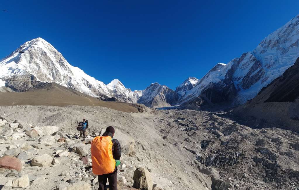
It's not going to be easy to cross that glacier tomorrow. And somewhere in the mountains beyond it, the Cho La Pass is waiting.
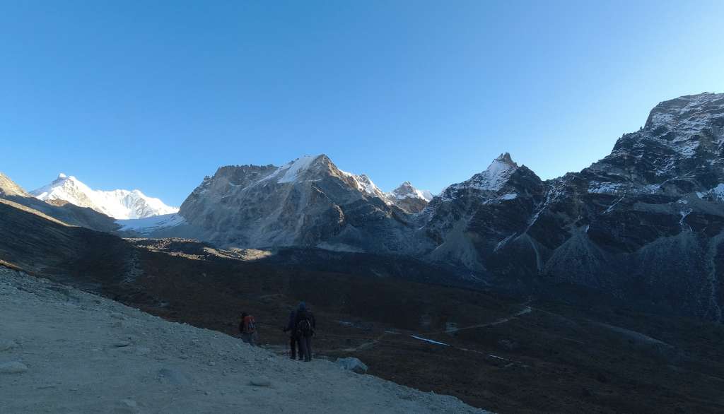
Our first sight of the Cho La Pass 5,420m (17,782ft) sitting between the 2 mountains right in the centre of the picture. All of us fell silent on seeing her. Subdued and, quite frankly, scared as we crossed the dead ground towards her.
Approaching from Dragnak and heading towards the Everest Base Camp Trail, the climb is rocky and looks near vertical. A metal rope is pegged into the rocks along the length of the ascent. The main ascent starts up the left-hand side of the pass as you look at it. After about 400ft of airy, exposed, rocky steps and loose scree, a long traverse brings you onto the band of dark coloured rock you can see in the picture.
"How am I ever going to make that?!" seems to have been the common thought as we looked up from there to the pass itself. The answer, another couple of hundred feet of near vertical, high, rocky steps. Personally, I had to stop and rest after almost every step. Eventually, about half an hour behind the main group, I emerged exhausted onto the pass.
The traditional Everest Base Camp Route rolls out before us. The steep rocky path descending from the memorials of the Thukla Pass (out of picture) to the teahouses of Thukla (centre of picture). Looking right, we see the route back to Dingboche and the drop down from Thukla to the Pheriche valley which will be on the route of our descent in a few days.

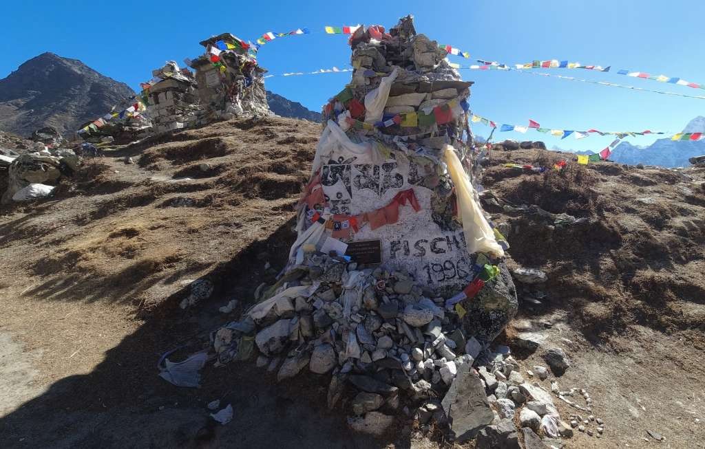
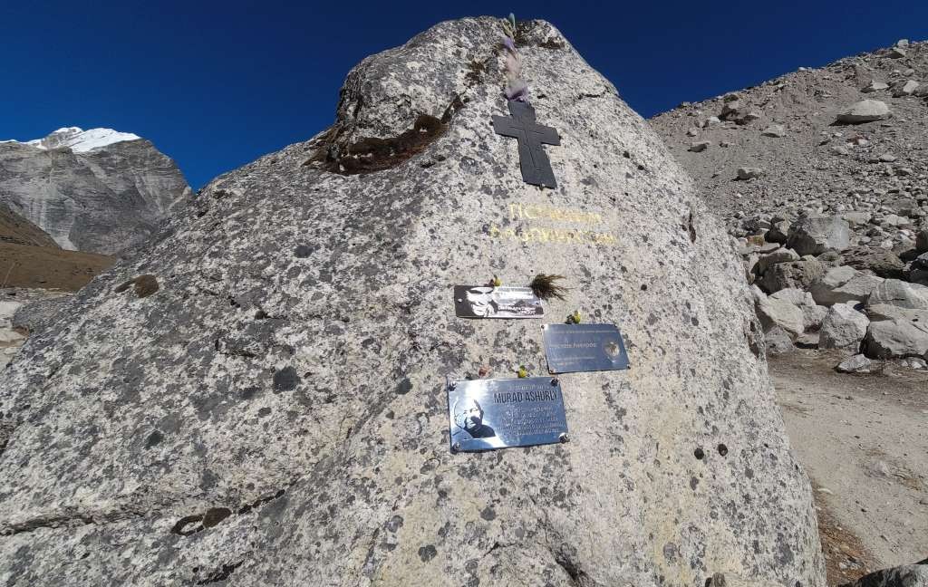
Whether reaching the top of the steep rocky climb out of Thukla on the way to Everest Base Camp or descending from Lobuche as we did on the return to Lukla, you'll wander into a place of the dead. The Thukla Pass holds memorials dedicated to the memory of the hundreds who have died on Everest. From Scott Fisher, immortalized in several books and the movie Everest, to people unknown to me but shining long in the hearts of mothers, brothers, daughters and sons. It is a place of silence, beauty and spirituality. I whisper my prayers to eternity and, like so many times on this journey, feel humble and small.
Some mornings you just don't quite feel sorted. This morning I left the teahouse in Lobuche with liners instead of gloves on my hands. I had to stop and put my gloves on. By the time I did I was in tears with the pain in my fingers as we crunched our way up the frozen valley. I could see the sun ahead in the mountains and I prayed for it to reach us and thaw us out.
The sun reached us at the top of the valley at the foot of the moraine of the Khumbu Glacier. I went from utterly freezing to overheated and dehydrated with nothing in between.
Clambering through the endless boulders on the approach to Gorakshep (the last settlement on the Everest Base Camp Trail) things finally started to settle. My down jacket and gloves were packed away, and my water supply had thawed.
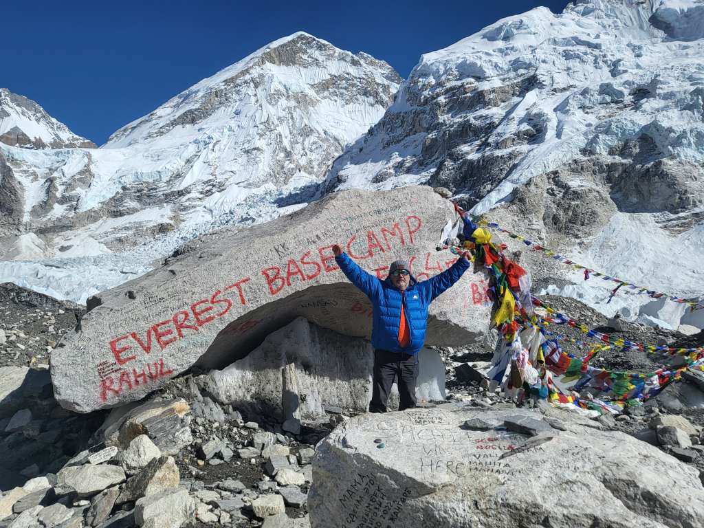
As I clambered into the clearing among the rocks and ice that is identified as Everest Base Camp, 5,364m (17,598ft), my steady exhausted panting turned to broken sobs. Tears rolled out from under my glasses as exhaustion was washed away in a wave of raw emotion.
It was seeing the embrace of Will and Becks (2 of our group) as they arrived that started me off, but I think I was already pretty tender.
I'd been here before 6 years ago exhausted then as now, elated just the same. Time passes, we get older but the immensity of standing in a place like this never does. I guess that's why I came back. Because a journey like this never strays far from your mind. It's always in your heart.
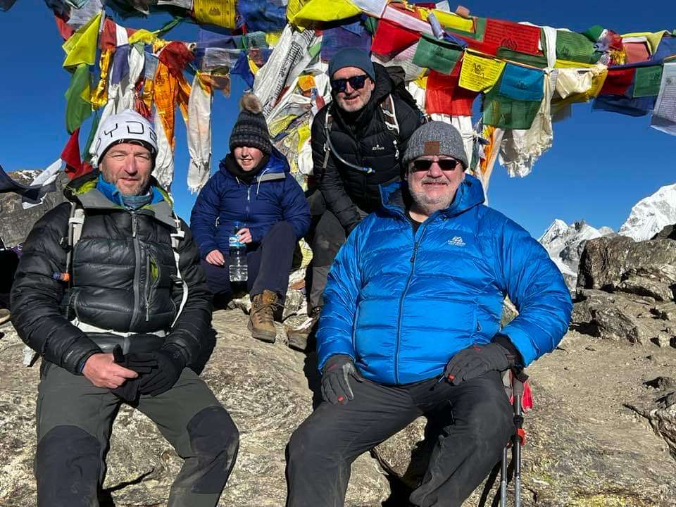
Here is the team on top of the Cho La Pass. (Left to right) Andy, Will, Becks and me, Sean.
Andy put up with my snoring, often lost at cards and often tried to clear rocks from the path in front of me whenever he saw me tripping.
Will and Becks are a couple. They constantly looked out for me on the journey. They gave me encouragement and always made me smile.
These guys are amazing. When I consider that the memories of what we achieved will last forever, I know they couldn't have been achieved without these guys. Their positive, gentle spirit and their ever-present encouragement and help were a total blessing.
Our lead guide on this trek is typical of the Sherpa people. I never managed to get his permission to mention his name in this article, but I'll describe what his help meant to me and our group. He is small, quiet, polite and superhuman. Not just his strength and his fitness but his attentiveness and his patience.
He always hung back with me when I couldn't match the pace of the group. Even carried my bag at times when I was struggling. Countless times I dropped a walking pole and he always beat me to it to pick it up for me. Every single time I tripped; he steadied me before I could fall.
A man as mountainous as the mountains around him. A soul in harmony with this place.
Him and his nephew cleared every obstacle and were always there. We simply couldn't have made this trek without them.
Location (Map)
When you subscribe to the AllWays Traveller, we will send you an e-mail when there are new updates on the site so you wouldn't miss them.
About the author
Contact info
![]()
ISSN 2634-7032
London, United Kingdom
+44 0 7764 198 286